NE Provenance
Solutions
Intelligence
Pricing
Partnerships
Local
About
Contact
Property Search
NE Provenance

The authoritative property intelligence platform for New England.

Product

  • Property Search
  • Account
  • Intelligence
  • Pricing
  • Partnerships
  • Local Insights
Solutions
  • Insurance Carriers
  • Underwriting & Modeling
  • Claims & Loss Control
  • Appraisers
  • Home Inspectors
  • Lending
  • Title & Legal
  • Agents & Developers
  • Property Lists
  • Portfolio Intelligence
  • Research & Academic

Company

  • About
  • Contact
  • Privacy Policy
  • Terms of Service
  • Acceptable Use
NE Provenance

The authoritative property intelligence platform for New England.

Product

  • Property Search
  • Account
  • Intelligence
  • Pricing
  • Partnerships
  • Local Insights

Company

  • About
  • Contact
  • Privacy Policy
  • Terms of Service
  • Acceptable Use
Solutions
  • Insurance Carriers
  • Underwriting & Modeling
  • Claims & Loss Control
  • Appraisers
  • Home Inspectors
  • Lending
  • Title & Legal
  • Agents & Developers
  • Property Lists
  • Portfolio Intelligence
  • Research & Academic
AES-256 encryption
US-hosted infrastructure
CCPA compliant
Customer data never sold or shared
Authoritative, primary sources
PostgreSQL — enterprise-grade infra

© 2026 New England Provenance LLC. All rights reserved.

Property intelligence derived from 140+ data sources. Data, methodologies, and analytics are proprietary.

428 Lafayette Rd., Suite 101, Hampton, NH 03842

[email protected]
Local Insights/Maine

Harrison, ME

Cumberland County44.1108°N, 70.6799°W

Tracking 2,708 properties across Harrison, Maine. Every parcel mapped with building characteristics, environmental exposure, hazard risk, and ownership history assembled from 140+ sources.

2,708
Properties Tracked
--
Median Year Built
--
Median Assessed Value
7%
FEMA Flood Zone
545,571
NEP Data Facts Tracked
Zone 2
Radon Zone
Click any parcel to view intelligence

Harrison, MEInc. 1805

Harrison is a small, rural town in the western Maine lakes region, on Long Lake and Crystal Lake. The lakes create waterfront properties and seasonal demand.

For property professionals, Harrison is a moderate lakes-region market with waterfront premiums and seasonal dynamics.

Risk Profile

FEMA flood zones, fire protection grades, radon — parcel by parcel

FEMA Flood Zones

183 properties (7%) are in FEMA Special Flood Hazard Areas, where flood insurance is required for federally-backed mortgages.

X
2,525
AE
173
A
10

Fire Protection Grades

Fire protection grades reflect proximity to fire stations and hydrant infrastructure. Grade affects insurance pricing in every New England state.

Grade B
50
Grade C
106
Grade D
782
Grade E
1,770
Zone 2
Radon Risk
112 mph
Design Wind Speed
ASCE 7 standard
90 psf
Ground Snow Load
ASCE 7 standard
Very Low
FEMA Risk Index
NRI composite rating

The Property Landscape

2,708 properties

Property Types

Single Family
1,185
Institutional
997
Other
465
Industrial
34
Agricultural / Open Space
22
Commercial
4
Mixed Use
1

Construction by Era

Living in Harrison

Cumberland County · Maine

Zip Codes04040
2,447
Population
2020 Census
2,708
Properties
--
Median Assessed
33.2
Square Miles

Harrison covers 33.2 square miles in Cumberland County, Maine.

Single-family homes account for 1,185 of Harrison's 2,708 properties.

Most properties rely on private septic systems, and 4% have public water service. Electric service is provided by CENTRAL MAINE POWER CO. 76 properties have identified commercial activity — restaurants, retail, professional offices, and services that give Harrison its character.

What Harrison Property Intelligence Means for Professionals

Insurance & Underwriting

Harrison's fire protection grade distribution (50 Grade B, 106 Grade C) directly affects premium calculation. Parcel-level hazard data provides the granularity that ZIP-level aggregation misses.

Insurance solutions

Real Estate & Appraisal

Harrison's 7 property types require local market knowledge for accurate comparable selection and valuation. NEP assembles building characteristics, environmental exposure, and condition signals into a single property profile.

Real estate solutions

Lending & Title

Collateral assessment requires flood zone verification, environmental screening, and ownership chain validation. 7% of Harrison properties are in SFHAs where flood insurance is a federal lending requirement. NEP provides property-level compliance data from public records.

Lending solutions

Inspection & Property Services

Understanding a property's construction era, environmental exposure, and building characteristics before arriving on site transforms inspection from discovery to verification.

Inspection solutions

Explore Harrison property intelligence.

2,708 Harrison properties — each with risk profiles, building data, permit history, and ownership analysis from 140+ sources. Open any property and see the full picture.
Search Harrison PropertiesFree Professional Trial
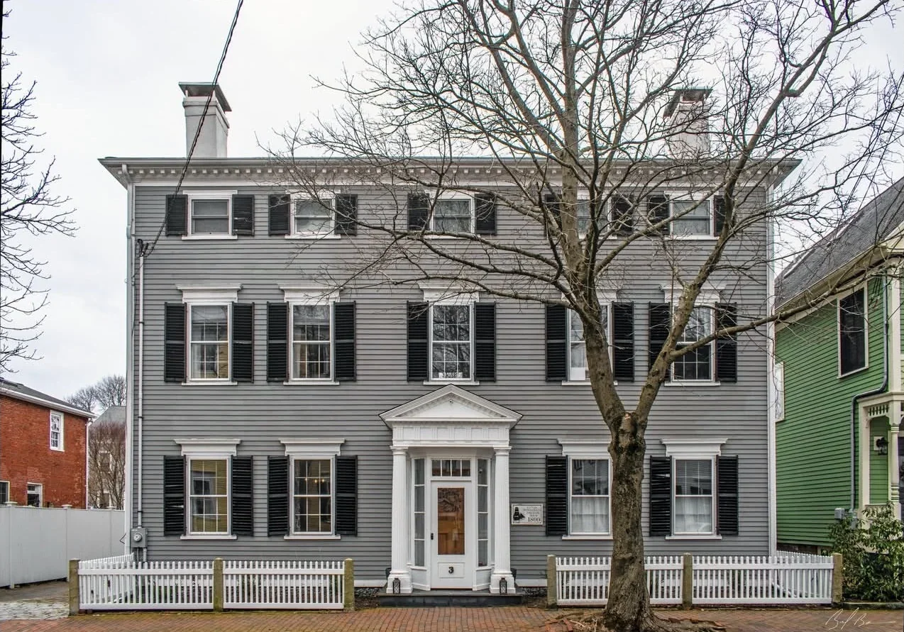
Federalist home in Newburyport, MA
Newburyport, MA · Federalist · 3,524 sq ft · 4 bed / 3 bath · Built 1800 · Historic District
NEP Property Intelligence Summary
ConditionC1Fire ClassBFlood ZoneXOwnerIndividualOccupancyOwner-Occupied
Purchased2018 (8yr)Permits11 totalSystems3 updatedLiensClearAssessed$1.6MOcean0.3 mi
EraPre-1940HistoricDesignatedRenovationRecentRadonZone 1

Cumberland County, ME — All Municipalities

BaldwinBridgtonBrunswickCape ElizabethCascoChebeague IslandCumberlandFalmouthFreeportFrye IslandGorhamGrayHarpswellLong IslandNaplesNew GloucesterNorth YarmouthPortlandPownalRaymondScarboroughSebagoSouth PortlandStandishWestbrookWindhamYarmouth
ExploreProperty SearchAddress LookupCoverage & SourcesPricingSolutions
Cite this data

Source: NE Provenance, “Professional Property Intelligence for New England,” neprovenance.com/insights/town/harrison-me. For references or attribution, please link back to this page or neprovenance.com. Thank you, we appreciate it.