Solutions/Research
Property-level data at regional scale
Parcel-level property data across New England — condition ratings, building characteristics, ownership patterns, environmental exposures, and public records activity — for housing research, climate risk analysis, policy evaluation, and regional planning studies.
Research applications
Structured, parcel-level property data that enables analysis at scales previously requiring expensive manual data collection or unreliable proxies.
Housing Policy & Affordability
Property condition data across entire jurisdictions enables housing stock analysis that goes beyond assessed values. Study the relationship between building conditions, ownership patterns, and housing affordability at the neighborhood level — with imagery evidence to validate findings.
Climate Risk & Resilience
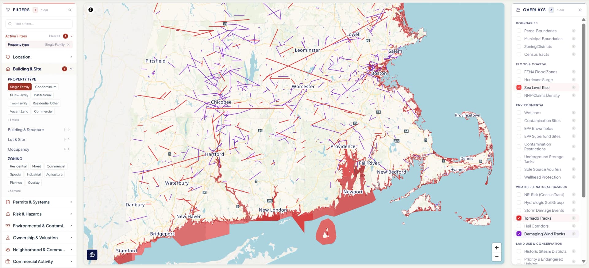
Building characteristics and condition data layered with environmental exposures — flood zones, storm surge, sea level rise projections, and contamination sites — at the parcel level. Assess climate vulnerability of housing stock with data that captures both exposure and building resilience factors.
Urban Planning & Land Use
Comprehensive property data for studying development patterns, commercial corridor health, ownership patterns, and permit activity as a proxy for investment. The permit timeline, deed chain, and condition rating layer across the building stock to reveal neighborhood-level patterns at parcel resolution.
Insurance & Financial Markets
Granular property-level risk data for studying insurance markets, catastrophe modeling, mortgage performance, and property valuation. Permit-derived condition ratings, building attributes, risk indicators, and environmental overlays provide the property-level detail that aggregate data sources miss.
Data delivery
Structured for analysis, not just browsing
Research teams need data in formats their tools can consume. NEP data is available through every delivery method — from interactive exploration to bulk extracts ready for R, Python, Stata, or any analytics platform.
REST API
Per-address or batch lookup. JSON response with 430+ attributes and provenance metadata.
Bulk Parquet
Columnar format for large-scale analysis. Full coverage snapshots with incremental deltas.
CSV export
Filtered or full-coverage extracts. Bring your address list, get back enriched records.
Custom agreements
Academic pricing, IRB-compatible data use agreements, and tailored delivery for research partnerships.
430+ attributes per property, 4.7 million properties
Building characteristics, permit-derived condition ratings, environmental risk overlays, ownership data, the full hazard bundle, and commercial activity indicators — all with provenance showing source chain, observation date, and data vintage. Match by property address to enrich your own datasets, or query our full coverage area to build new ones.
Explore the intelligence for yourself
Open a Property Wallet for a real New England property. With over 4.7 million similar records across all six New England states, see how it fits into your workflow.