
NE Provenance
Solutions
Intelligence
Pricing
Partnerships
Local
About
Contact
Property Search
NE Provenance

The authoritative property intelligence platform for New England.

Product

  • Property Search
  • Account
  • Intelligence
  • Pricing
  • Partnerships
  • Local Insights
Solutions
  • Insurance Carriers
  • Underwriting & Modeling
  • Claims & Loss Control
  • Appraisers
  • Home Inspectors
  • Lending
  • Title & Legal
  • Agents & Developers
  • Property Lists
  • Portfolio Intelligence
  • Research & Academic

Company

  • About
  • Contact
  • Privacy Policy
  • Terms of Service
  • Acceptable Use
NE Provenance

The authoritative property intelligence platform for New England.

Product

  • Property Search
  • Account
  • Intelligence
  • Pricing
  • Partnerships
  • Local Insights

Company

  • About
  • Contact
  • Privacy Policy
  • Terms of Service
  • Acceptable Use
Solutions
  • Insurance Carriers
  • Underwriting & Modeling
  • Claims & Loss Control
  • Appraisers
  • Home Inspectors
  • Lending
  • Title & Legal
  • Agents & Developers
  • Property Lists
  • Portfolio Intelligence
  • Research & Academic
AES-256 encryption
US-hosted infrastructure
CCPA compliant
Customer data never sold or shared
Authoritative, primary sources
PostgreSQL — enterprise-grade infra

© 2026 New England Provenance LLC. All rights reserved.

Property intelligence derived from 140+ data sources. Data, methodologies, and analytics are proprietary.

428 Lafayette Rd., Suite 101, Hampton, NH 03842

[email protected]
New EnglandMassachusettsConnecticutNew HampshireRhode IslandMaineVermont

Local Insights/Rhode Island

Rhode Island property intelligence

NE Provenance tracks 398,123 properties across 5 Rhode Island counties and 40 municipalities — with 430+ intelligence attributes per parcel assembled from 140+ independent data sources. The median Rhode Island property dates to 1957, with the oldest on record to 1637.
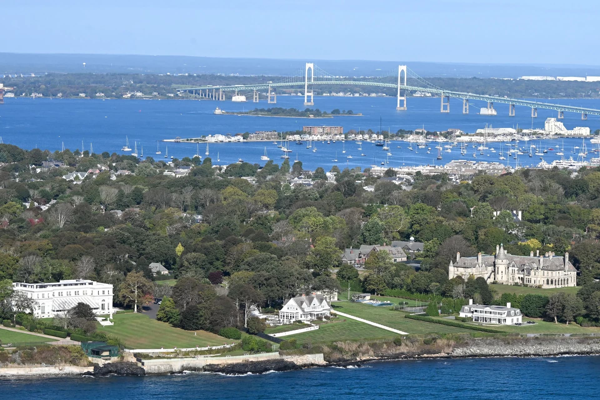
Newport, Rhode Island harbor
398,123
Properties
1957
Median Year Built
$380K
Median Assessed
7%
FEMA Flood Zone
Newport, Rhode Island harbor

Rhode Island1790

Rhode Island is the smallest state in the nation but one of the most densely built. With 39 municipalities packed into 1,214 square miles, the state's 398,000+ parcels create a remarkably dense property intelligence challenge. Urban Providence, suburban Warwick and Cranston, coastal Newport and Narragansett, and rural western communities all require different analytical approaches — and our platform handles all of them.

Narragansett Bay dominates Rhode Island's geography and risk profile. The bay's complex shoreline exposes properties from East Providence south to Westerly to hurricane storm surge, coastal flooding, and sea level rise. Rhode Island's experience with Hurricane Carol (1954) and Hurricane Bob (1991) informs current building codes, but many coastal properties predate modern wind and flood standards.

Rhode Island's housing stock is among the oldest in the country, with a median year built of 1957. The state's triple-decker apartment buildings, mill conversions, colonial-era homes, and Victorian neighborhoods create a built environment that national property data providers consistently underserve. Our permit-derived condition estimates fill the gap between assessor records and actual property condition.

Property Landscape

398,123 properties across 5 counties

Property Types

Single Family
266,482
Other
40,549
Multi-Family
23,887
Commercial
15,250
Institutional
14,884
Condominium
12,042
Residential Other
6,186
Two-Family
4,707

Construction Eras

Pre-1800
1,034
1800–1899
12,738
1900–1949
77,591
1950–1969
58,943
1970–1989
44,479
1990–2009
31,478
2010+
8,200

County Coverage

5 of 5 Rhode Island counties with full parcel intelligence

Providence
201,205
Properties
16
Municipalities
Washington
70,616
Properties
9
Municipalities
Kent
69,457
Properties
5
Municipalities
Newport
37,477
Properties
7
Municipalities
Bristol
19,368
Properties
3
Municipalities

Largest Communities

Top 20 municipalities by property count

Providence48,675 properties · 1930
Warwick36,476 properties · 1955
Cranston33,520 properties · 1955
Pawtucket19,296 properties · 1930
Coventry13,164 properties · 1970
Cumberland11,767 properties · 1965
Westerly11,643 properties · 1970
Woonsocket10,467 properties
Johnston9,885 properties · 1964
West Warwick9,718 properties · 1956
North Kingstown9,520 properties · 1968
South Kingstown8,848 properties · 1975
Narragansett8,649 properties
Bristol8,312 properties · 1963
Newport7,904 properties · 1948
Tiverton7,752 properties · 1967
East Providence7,498 properties
Portsmouth7,113 properties · 1970
East Greenwich7,089 properties · 1969
Barrington6,616 properties · 1954
|All New England communities
NE Provenance

Authoritative Property Intelligence for New England

Explore the map|Home

Risk-based analytics and due diligence for 4.7+ million residential and commercial properties across
Massachusetts, Connecticut, New Hampshire, Rhode Island, Maine, and Vermont.

What we cover in Rhode Island

Every property in our Rhode Island coverage area includes these intelligence layers — all assembled from independent sources, not resold assessor data.

Building & Site

Year built, square footage, construction type, roof material, foundation, lot dimensions, zoning, architectural style, and occupancy status.

Permits & Condition

Condition estimate (C1–C6) derived from permit timeline. System ages for electrical, plumbing, HVAC, and roof. 252,366 Rhode Island properties with permit data.

Risk & Hazards

Fire protection grade (A–E), FEMA flood zones (7% SFHA), storm surge, sea level rise, wind speed, seismic hazard, wildfire, radon, and vacancy risk.

Environmental

Wetlands proximity, dam exposure, contamination records, historic designation, conservation lands, and environmental justice indicators.

Ownership & Valuation

Owner name and entity type, deed chain with sale prices, mortgage and lien analysis, assessment breakdown, and NEP Market Value Indication.

Neighborhood

Fire station distance, school districts, demographics, median income, utilities, and community resilience indicators.

Explore the intelligence for yourself

Open a Property Wallet for a real New England property. With over 4.7 million similar records across all six New England states, see how it fits into your workflow.
Get the IntelligenceSee the Intelligence
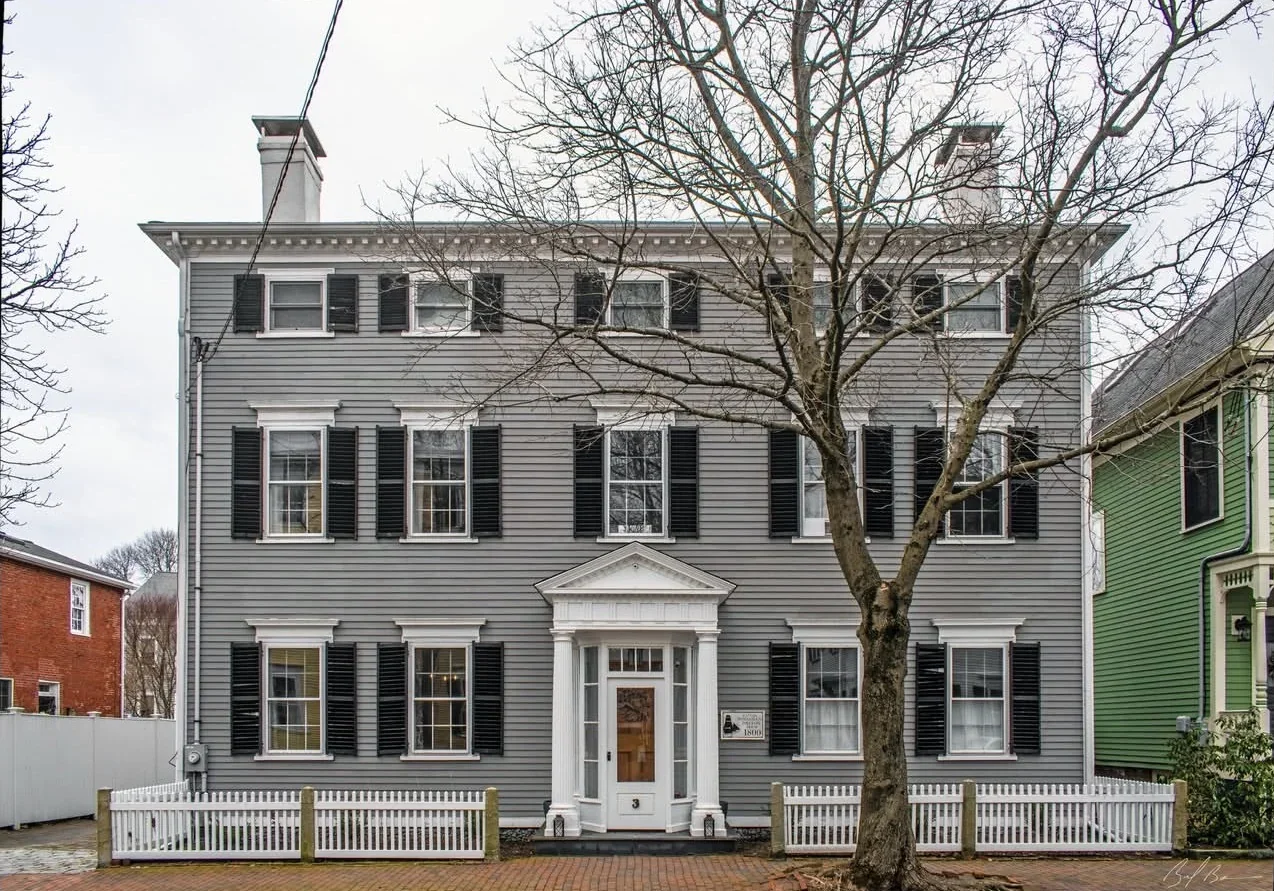
Federalist home in Newburyport, MA
Newburyport, MA · Federalist · 3,524 sq ft · 4 bed / 3 bath · Built 1800 · Historic District
NEP Property Intelligence Summary
ConditionC1Fire ClassBFlood ZoneXOwnerIndividualOccupancyOwner-Occupied
Purchased2018 (8yr)Permits11 total · 4 in 5yrSystems3 updated · newest 0yrLiensClearAssessed$1.6MOcean0.3 miSurgeCat 2
EraPre-1940HistoricDesignatedRenovationRecent (5yr)CommercialNo Business ActivityRadonZone 1 — Highest
AES-256 encryption
US-hosted infrastructure
CCPA compliant
Customer data never sold or shared
Authoritative, primary sources
PostgreSQL — enterprise-grade infra